All Content Copyright 2017, Terraform 3d. Site design by ![]()
TerraForm 3D use the latest technology to scan and produce surface models for engineering, earthmoving, and commercial real estate.
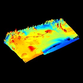
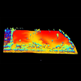
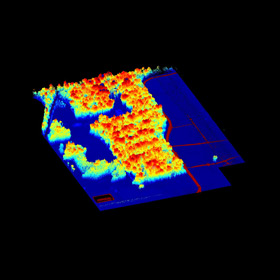
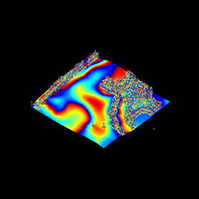
TerraForm 3D uses the Microdrones mdLidar1000. This LiDAR unit is capable of collecting a point density of 40 to 160 data points per meter square, approximately 39" x 39". This average point density is based on the height and speed of the flight as well as the amount of overlap. Different conditions call for different flying parameters. Even small acreage can generate millions of data points, far outpacing conventional means of collection. 3D data collection with LiDAR is also safer, more efficient, and less expensive when used in certain environments.
This 3D data, collected from a site such as an open field, a light to heavily vegetated area or even a wooded tract of land, can be used to produce contours and surface models for use in development. It is invaluable for areas with heavy vegetation which would otherwise be laborious, time consuming, and more expensive when using conventional methods for terrain modeling.
Below are just a few examples of our services in action.

SENDING...
All Content Copyright 2017, Terraform 3d. Site design by ![]()